Indonesian Fires Drive a Regional Air-Quality Emergency
Forest and peatland fires across Indonesian Borneo have overwhelmed firefighters and generated hazardous haze, with West Kalimantan enduring more than two months without rain amid a powerful El Niño.[2][4] PM2.5 in Pontianak exceeded 500 micrograms per cubic metre at one point, hundreds of schools…
Forest and peatland fires across Indonesian Borneo have overwhelmed firefighters and generated hazardous haze, with West Kalimantan enduring more than two months without rain amid a powerful El Niño.[2][4] PM2.5 in Pontianak exceeded 500 micrograms per cubic metre at one point, hundreds of schools closed and roughly 200,000 pupils shifted to home learning.[4] Smoke has also affected neighbouring Malaysia and reached the Philippines.[2][4]
Why it matters: The fires have become a cross-border public-health crisis: Indonesia has reported tens of thousands of associated respiratory infections, while Greenpeace estimates that 35 million people nationally are exposed to toxic haze.[2][4] The crisis also highlights how drought interacts with forest degradation, land clearing and drained peatlands that can burn underground for extended periods.[4]
Key insights: More than 285,000 hectares have burned across Indonesia this year, including 38,000 hectares in West Kalimantan, according to figures cited by France 24.[4] | An Air Quality Index reading in Pontianak exceeded 900, while visibility sometimes fell below one kilometre and as low as 200 to 500 metres.[2] | Experts attribute the conditions to a stronger-than-usual El Niño alongside climate change, forest degradation and slash-and-burn land clearing.[4] | Draining peat for oil-palm and pulpwood plantations leaves it dry and flammable, according to Greenpeace Indonesia.[4]
Cheatsheet facts: What changed: Intense fires and haze have spread across Indonesian Borneo and beyond, closing schools and driving pollution to hazardous levels.[2][4] | Why now: More than 60 days without rain and a strong El Niño have depleted water sources, with dry conditions expected to peak in the coming weeks.[2] | Watch next: Track rainfall, PM2.5 readings, burned-area updates and whether Indonesia declares the fires a national disaster as campaigners have requested.[2][4]
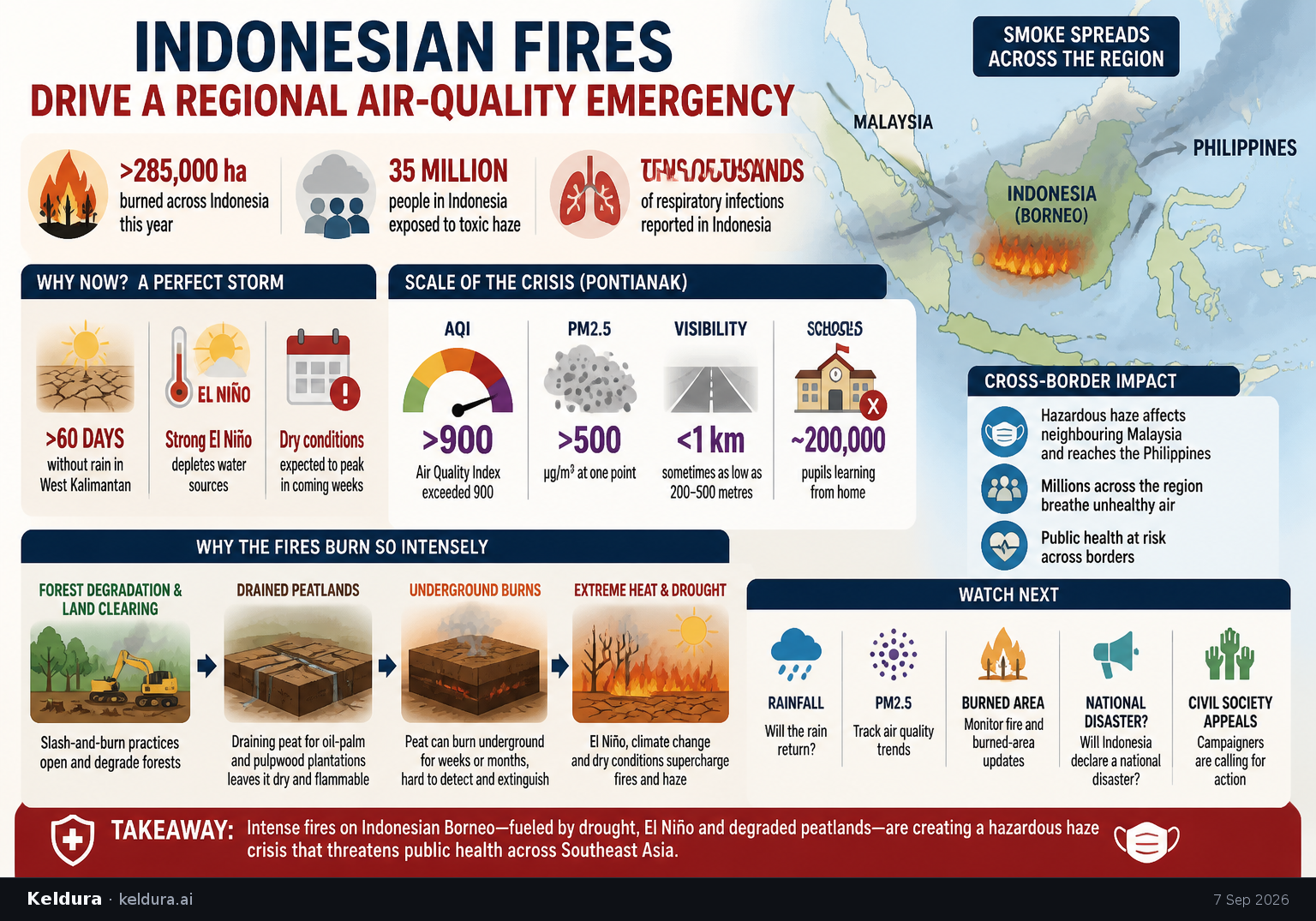
Forest and peatland fires across Indonesian Borneo have overwhelmed firefighters and generated hazardous haze, with West Kalimantan enduring more than two months without rain amid a powerful El Niño.[2][4] PM2.5 in Pontianak exceeded 500 micrograms per cubic metre at one point, hundreds of schools closed and roughly 200,000 pupils shifted to home learning.[4] Smoke has also affected neighbouring Malaysia and reached the Philippines.[2][4]
Why it matters: The fires have become a cross-border public-health crisis: Indonesia has reported tens of thousands of associated respiratory infections, while Greenpeace estimates that 35 million people nationally are exposed to toxic haze.[2][4] The crisis also highlights how drought interacts with forest degradation, land clearing and drained peatlands that can burn underground for extended periods.[4]
Key insights: More than 285,000 hectares have burned across Indonesia this year, including 38,000 hectares in West Kalimantan, according to figures cited by France 24.[4] | An Air Quality Index reading in Pontianak exceeded 900, while visibility sometimes fell below one kilometre and as low as 200 to 500 metres.[2] | Experts attribute the conditions to a stronger-than-usual El Niño alongside climate change, forest degradation and slash-and-burn land clearing.[4] | Draining peat for oil-palm and pulpwood plantations leaves it dry and flammable, according to Greenpeace Indonesia.[4]
Cheatsheet facts: What changed: Intense fires and haze have spread across Indonesian Borneo and beyond, closing schools and driving pollution to hazardous levels.[2][4] | Why now: More than 60 days without rain and a strong El Niño have depleted water sources, with dry conditions expected to peak in the coming weeks.[2] | Watch next: Track rainfall, PM2.5 readings, burned-area updates and whether Indonesia declares the fires a national disaster as campaigners have requested.[2][4]