Satellite Algorithm Identifies Winter Cover Crops
Researchers developed a phenology-based method that combines Harmonized Landsat and Sentinel-2 imagery with field observations and planting records to identify crops remotely.[8] Tests reported balanced accuracy of 75%–85%, with winter-cover-crop detection exceeding 90% in some cases.[8]
Researchers developed a phenology-based method that combines Harmonized Landsat and Sentinel-2 imagery with field observations and planting records to identify crops remotely.[8] Tests reported balanced accuracy of 75%–85%, with winter-cover-crop detection exceeding 90% in some cases.[8]
Why it matters: If deployed at scale, the method could help agencies verify conservation crops without visiting every field and assess practices intended to keep soil nutrients from entering waterways such as the Chesapeake Bay.[8]
Key insights: The algorithm tracks when vegetation appears, how long it grows and when it disappears to distinguish seasonal crop fingerprints.[8] | Its scoring system uses temporal and spectral indices derived from near-infrared, red and shortwave-infrared satellite bands.[8] | Harmonized Landsat and Sentinel-2 can provide observations nearly every day, allowing researchers to detect small lifecycle changes.[8]
Cheatsheet facts: What changed: A new satellite-analysis process can detect winter cover crops relatively early in winter and spring.[8] | Why now: Combined Landsat and Sentinel-2 imagery supplies the observation frequency needed to track crop phenology.[8] | Watch next: Watch for validation of the method across larger regions and operational use in conservation verification.[8]
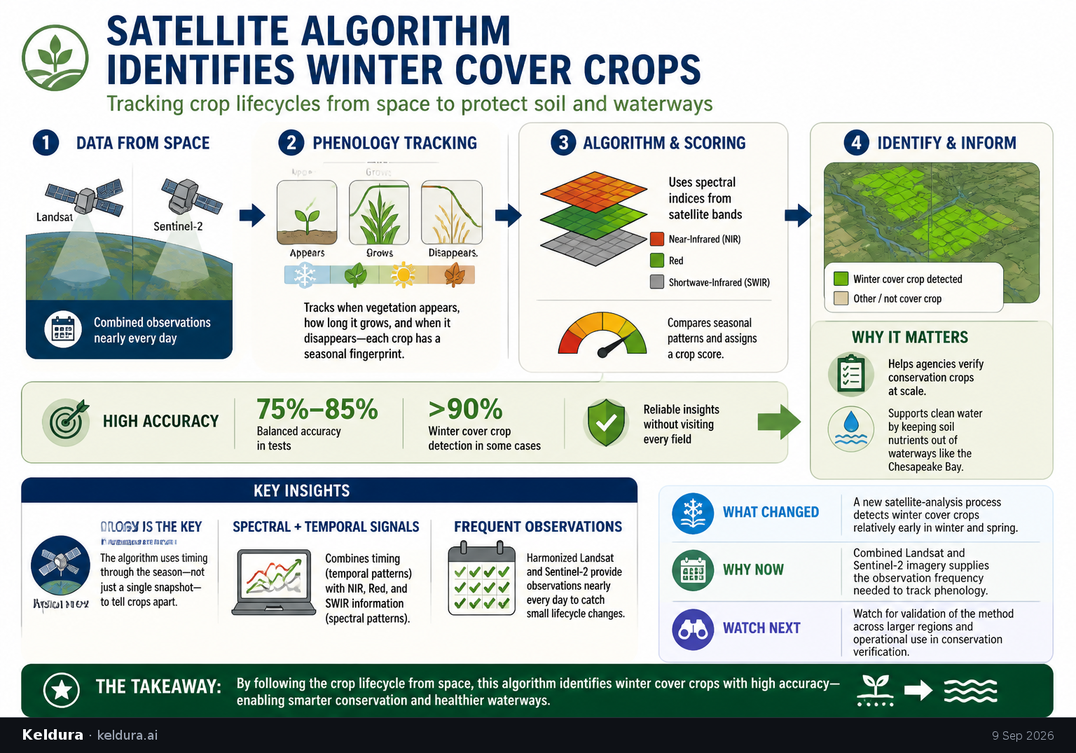
Researchers developed a phenology-based method that combines Harmonized Landsat and Sentinel-2 imagery with field observations and planting records to identify crops remotely.[8] Tests reported balanced accuracy of 75%–85%, with winter-cover-crop detection exceeding 90% in some cases.[8]
Why it matters: If deployed at scale, the method could help agencies verify conservation crops without visiting every field and assess practices intended to keep soil nutrients from entering waterways such as the Chesapeake Bay.[8]
Key insights: The algorithm tracks when vegetation appears, how long it grows and when it disappears to distinguish seasonal crop fingerprints.[8] | Its scoring system uses temporal and spectral indices derived from near-infrared, red and shortwave-infrared satellite bands.[8] | Harmonized Landsat and Sentinel-2 can provide observations nearly every day, allowing researchers to detect small lifecycle changes.[8]
Cheatsheet facts: What changed: A new satellite-analysis process can detect winter cover crops relatively early in winter and spring.[8] | Why now: Combined Landsat and Sentinel-2 imagery supplies the observation frequency needed to track crop phenology.[8] | Watch next: Watch for validation of the method across larger regions and operational use in conservation verification.[8]